Choosing a Mount Rinjani trekking route changes far more than the first day’s scenery. It determines which side of the national park you enter, the terrain you cross, the objectives you can reasonably include and where you finish.
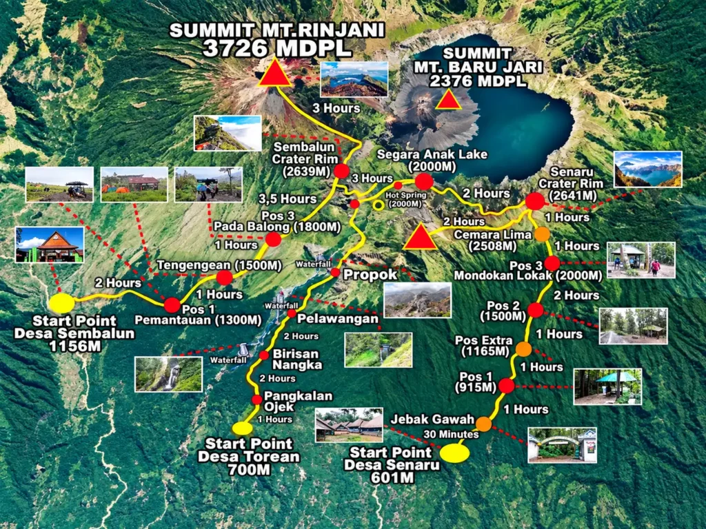
Gunung Rinjani National Park recognises six official trekking routes: Sembalun, Senaru, Torean, Timbanuh, Aik Berik and Tetebatu. Sembalun, Senaru and Torean are the best-known gateways for multi-day trips around the main caldera. The other three approach Rinjani from the south and offer different rim or highland experiences.
Not every route reaches the 3,726-metre summit, and an official trail is not automatically open every day. Use this guide to understand the main differences, then confirm current access and the exact itinerary with the national park and an authorised trekking organiser.
Rinjani Route Comparison at a Glance
| Route | General landscape | Common role in an itinerary | Best suited to |
|---|---|---|---|
| Sembalun | Open grassland, high ridges and volcanic slope | Primary approach for the main summit | Summit-focused trekkers with strong fitness |
| Senaru | Tropical forest and the northern crater rim | Crater-rim trip or start/end of a traverse | Forest scenery and a classic rim experience |
| Torean | River valley, cliffs and waterfalls | Access between the north and Segara Anak area | Dramatic valley scenery with an experienced guide |
| Timbanuh | Forested southern approach to Pelawangan Timbanuh | Southern crater-rim objective | A quieter official route without the main summit focus |
| Aik Berik | Forest, water-rich landscape and southern highlands | Approach to Pelawangan Aik Berik/Kondo Sangkareang area | A less-used southern alternative |
| Tetebatu | Forested southeastern approach | Route towards Kondo Sangkareang and possible connection with Aik Berik | Trekkers interested in a quieter cross-route plan |
The table is a planning overview, not a live access notice. Trail connections, camping locations and permitted objectives can change after weather, fire, maintenance or safety assessments.
1. Sembalun Route
Sembalun is the route most closely associated with an ascent of Rinjani’s main summit. The trail begins on the eastern side of the mountain, where open grassland and broad views dominate much of the early approach.
The route’s open terrain can feel deceptively gentle at first. There is limited shade, and the long climb towards the Sembalun crater rim builds fatigue before the summit attempt. Higher sections become steeper, and the pre-dawn climb to the summit crosses loose volcanic ground where each step can slide backwards.
Why choose Sembalun?
- It is the standard gateway for a main-summit itinerary.
- Open views begin early in the trek.
- It connects naturally with longer programmes involving Segara Anak and another exit route when conditions permit.
What should you consider?
- Sun exposure can be intense on the lower open slopes.
- The summit section is physically demanding and often cold and windy.
- A short itinerary compresses substantial ascent and descent into limited recovery time.
Travellers can compare a compact 2-day, 1-night Sembalun trek with a broader 3-day, 2-night Sembalun itinerary. Check the day-by-day plan carefully: the same starting village does not mean every package includes the same objective.
2. Senaru Route
Senaru approaches the mountain from the north. The trail is known for its long passage through tropical forest before reaching higher, more exposed terrain around the northern crater rim.
This is a strong choice for hikers who value forest and caldera views but do not need to stand on the main summit. Senaru also plays an important role in traverse itineraries, serving as a start or finish when permitted connections to Segara Anak and other routes are open.
Why choose Senaru?
- The forest creates a markedly different experience from Sembalun’s open grassland.
- A crater-rim programme can deliver major Rinjani scenery without the main summit climb.
- Senaru is useful for itineraries that cross the mountain rather than return by the same trail.
What should you consider?
- Tree roots, mud and sustained climbing can make the forest physically tiring.
- The rim is still a serious mountain objective with cold, wind and basic camping.
- Do not assume access between the rim, lake and other routes is open; landslides or maintenance can affect connections.
For a non-summit option, review the 2-day, 1-night Senaru route and ask whether the current programme ends at the crater rim or includes any additional connection.
3. Torean Route
Torean follows a dramatic river valley on the northern side of Rinjani. The landscape includes steep green walls, water sources and waterfalls, including the Penimbungan waterfall area. It is visually distinct from both the Sembalun grasslands and the Senaru forest ascent.
Many trekkers encounter Torean as a route between the Segara Anak area and the northern lowlands. Its scenery has made it increasingly well known, but popularity should not be confused with simplicity.
Why choose Torean?
- It offers valley and waterfall scenery not found on the summit approach.
- It can add variety to a multi-route itinerary.
- Water-shaped terrain makes the journey feel different from a ridge-based descent.
What should you consider?
- Some sections are narrow, steep or exposed.
- Rain can change footing and water conditions quickly.
- A guide who knows the route and its current hazards is essential.
Torean is often discussed as an exit, but direction and access should be selected according to official conditions, not social-media trends. Ask how the organiser handles exposed sections, group spacing and adverse weather.
4. Timbanuh Route
Timbanuh is an official southern approach leading towards Pelawangan Timbanuh. It is a different proposition from a standard Sembalun summit trip: the attraction is the quieter approach and southern crater-rim landscape rather than the most famous main-summit programme.
The route passes through vegetated terrain before reaching higher ground. Because it receives less international attention, online descriptions may be limited or inconsistent.
Why choose Timbanuh?
- It offers an official alternative to the busier northern and eastern gateways.
- The route focuses on a southern rim objective.
- It may appeal to experienced visitors returning to explore another side of Rinjani.
What should you consider?
- Transfer logistics and support arrangements may be less standardised.
- Current facilities and trail condition must be confirmed locally.
- It should not be booked on the assumption that it includes the 3,726-metre summit.
Ask the operator to name the exact turnaround point or camp, explain the daily elevation profile and confirm whether the trip returns by Timbanuh or uses another officially permitted connection.
5. Aik Berik Route
Aik Berik enters the Rinjani landscape from Central Lombok. The wider area is associated with forest, streams and waterfalls, creating a greener approach than the open Sembalun route. The official route leads towards Pelawangan Aik Berik and the Kondo Sangkareang highland area.
This route can suit trekkers seeking a less-used side of the national park rather than the conventional main-summit itinerary.
Why choose Aik Berik?
- The approach combines forested and water-rich landscapes.
- It offers a quieter alternative to the most heavily marketed routes.
- Its southern position may fit an itinerary based in Central Lombok.
What should you consider?
- A quieter route still contains serious mountain terrain.
- Facilities, rescue access and mobile coverage may be limited.
- “Second summit” terminology is sometimes used for the Kondo Sangkareang area, but it should not be confused with Rinjani’s 3,726-metre main summit.
Confirm the final objective in writing. A package name alone may not tell you which rim, peak or connection is actually included.
6. Tetebatu Route
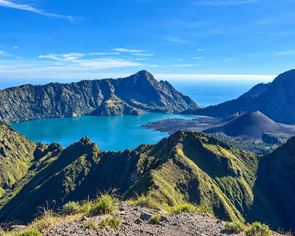
The official Tetebatu trekking route approaches from the southeast. It is separate from the short rice-field and waterfall walks commonly sold around Tetebatu village, so visitors should not confuse a village day walk with a national-park mountain expedition.
The mountain route heads through forested terrain towards the Kondo Sangkareang area and may be planned in connection with Aik Berik when the authorised route and conditions allow.
Why choose Tetebatu?
- It provides a quieter southeastern approach.
- The surrounding forest gives the journey a different character from Sembalun.
- A cross-route plan may suit experienced trekkers looking beyond the standard itineraries.
What should you consider?
- Confirm that you are booking the official mountain route, not a short village walk.
- Ask whether the planned connection is currently open and supported.
- This route should not be presented as a substitute for the standard main-summit approach.
Because Tetebatu is less familiar to many overseas visitors, insist on a detailed itinerary that names the entry point, camp, objective and exit point.
Which Route Reaches the Main Summit?
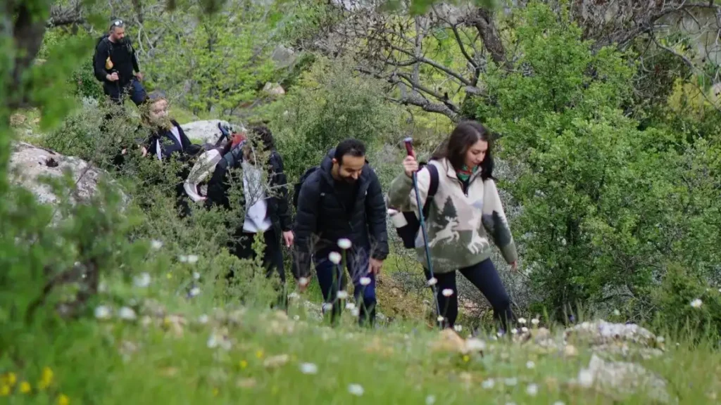
Sembalun is the primary approach used for Rinjani’s 3,726-metre summit. In a longer traverse, trekkers may begin elsewhere and connect towards the Sembalun side when the relevant route is open, but this creates a more complex itinerary.
Senaru, Torean, Timbanuh, Aik Berik and Tetebatu should not automatically be described as direct main-summit routes. Their common objectives and connections differ. If the main summit is essential to you, ask the organiser to show exactly where the summit attempt sits in the itinerary and which trail provides access.
If your main interest is understanding the volcano, preparation and camping experience rather than comparing entrances, start with the general Mount Rinjani guide.
Which Rinjani Route Is Best for Beginners?
There is no universally easy Rinjani route. Even a crater-rim itinerary includes sustained ascent, mountain weather and basic camping.
For a fit first-time trekker who does not want the main summit, a Senaru crater-rim programme may be easier to understand and arrange than a less-used southern route. For a first-timer committed to the summit, Sembalun is the conventional approach, but proper training remains necessary.
Do not select Torean merely because it is often used downhill. Descending a route can be hard on the knees, and exposed or wet sections may feel more difficult on the way down. Likewise, do not assume a lower or quieter southern objective is risk-free.
The best beginner route is the one that matches the walker’s actual fitness, includes enough time and is supported by a competent guide.
One-Way Traverse or Return by the Same Route?
A return itinerary uses the same trail to enter and leave. It simplifies transport and may reduce the number of trail connections that depend on current access.
A traverse starts and finishes at different gateways. It delivers more varied scenery, but it also adds logistical and physical complexity. Your organiser must coordinate transport, registration, camps and any route-specific restrictions.
Before choosing a traverse, ask:
- Are all connecting sections currently open?
- Which route is used for entry and which for exit?
- Does the plan include Segara Anak or a crater rim only?
- Where is the hardest ascent and descent?
- How will pickup work if the group finishes late?
- What is the alternative if weather closes a connection?
Avoid an itinerary that is vague about any of these points.
How Many Days Should You Allow?
Two-day itineraries usually concentrate on one principal objective, such as a crater rim or a fast summit programme from Sembalun. Three-day itineraries can include more of the caldera landscape or distribute the route across different gateways.
However, the number of days is not a reliable measure by itself. A two-day rim trek and a two-day summit trek have very different demands. Compare walking hours, elevation change, camp locations and sleep schedule rather than choosing only by price or duration.
Less-used southern routes may follow schedules that differ from common Sembalun and Senaru packages. Ask for a written day-by-day plan and do not transfer assumptions from one route to another.
Check Current Access Before You Book
Gunung Rinjani National Park can close or limit individual routes because of severe weather, wildfire risk, volcanic conditions, maintenance or an emergency. Seasonal closures may also apply. Online booking availability can change independently of older package pages.
Confirm all of the following shortly before travel:
- the selected entrance is officially open;
- the intended camps and connections are permitted;
- space is available through the current eRinjani process;
- your guide or trekking organiser meets current requirements; and
- the itinerary has a realistic alternative if conditions change.
Treat any old map, blog or GPS track as background information only. Follow official signs and guide instructions on the mountain.
Route Safety and Responsible Trekking
Every Rinjani route crosses a protected mountain environment. Stay on the authorised trail, remain with your group and tell the guide as soon as you feel unwell. Do not wait until exhaustion, dehydration or injury becomes severe.
Carry reusable food and drink containers, and make sure the group packs out all waste. Toilets and rest facilities may be basic or unavailable on parts of the route. Follow the organiser’s sanitation system and never leave tissue, wipes or food scraps behind.
On narrow or exposed ground, give other hikers space and avoid overtaking unless your guide says it is safe. If visibility deteriorates, slowing down or turning back is a sound mountain decision—not a failed trip.
Frequently Asked Questions
How many official Mount Rinjani trekking routes are there?
The national park lists six official routes: Sembalun, Senaru, Torean, Timbanuh, Aik Berik and Tetebatu.
What is the best route for the Rinjani summit?
Sembalun is the standard approach for the 3,726-metre main summit. Confirm that the package explicitly includes the summit attempt and check current trail status.
Which route has the most forest?
Senaru is well known for its long forest approach. Aik Berik, Timbanuh and Tetebatu also include forested terrain, while Sembalun is more open during its lower stages.
Is Torean an easy route?
No. Torean offers spectacular valley scenery, but it includes steep, narrow and potentially wet sections. It requires an experienced guide and careful decisions in poor weather.
Do all Rinjani routes visit Segara Anak?
No. Access to the lake depends on the route, direction, itinerary and current permissions. Ask for the exact overnight stops and objective before booking.
Are Tetebatu village walks part of the Rinjani mountain route?
Not necessarily. Short rice-field and waterfall walks around the village are different from the official Tetebatu national-park trekking route.
Choose the Route Before You Choose the Package
Sembalun, Senaru and Torean reveal different faces of the main caldera, while Timbanuh, Aik Berik and Tetebatu open quieter approaches from the south and southeast. The right route depends on whether you want the main summit, a crater rim, Segara Anak, forest, valley scenery or a less-used trail.
Start with that objective, then compare realistic itineraries. Contact Rinjani Trip with your fitness level, previous hiking experience, available days and preferred scenery. The team can match those priorities to a suitable open route and confirm the latest national-park requirements before you commit.